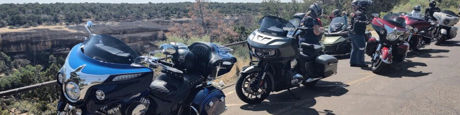
Route maps from some of the Northern Colorado Indian Motorcycle Riders Group rides. These routes are created in the online Ride Command mapping tool on the Indian Motorcycle website. You can download the GPX (GPS data file), and upload to your Ride Command on your Indian Motorcycle (or other device).
* Note: you may need to turn off your browser’s ad blocker to allow the map to load.
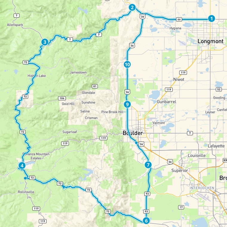
| Lefthand Canyon Ride Lefthand Canyon is one of the best rides in the Boulder area. Start at Love’s Travel in Berthoud. Ride toward Boulder to Lefthand Canyon. Ride to Ward, then up Peak-to-Peak Hwy. Head to Lyons then back to Berthoud. Route is 84 miles with estimated 2 hour ride time, and has a max elevation climb of 9,280 feet. Mountainous roads with lots of curves. | 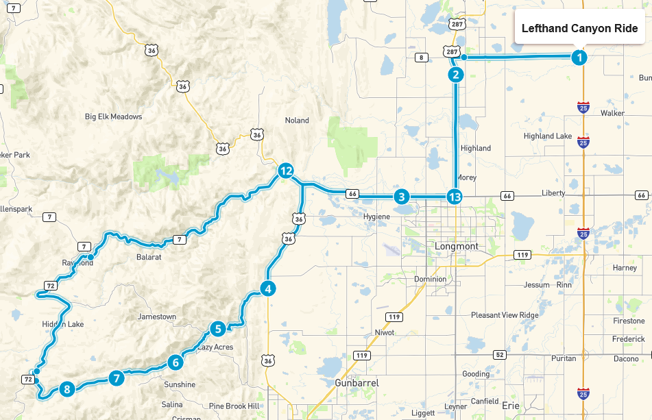 |
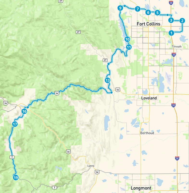
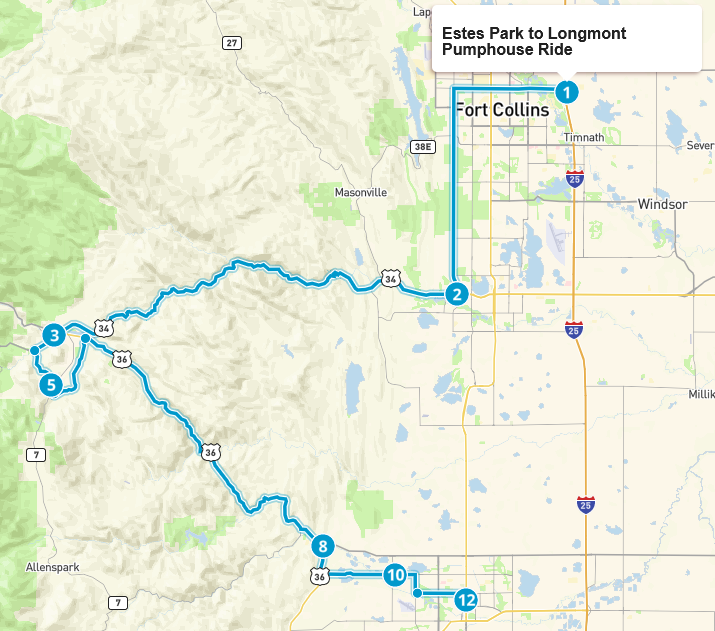 | Estes Park to Longmont Pumphouse Ride Starting at the Fort Collins Indian Motorcycle Dealership, ride up the Big Thompson Canyon, and jaunt through the outskirts of Estes Park. After passing through Estes, head down to Longmont on Hwy 36 for lunch at the Pumphouse. Route is 88 miles with estimated 2 hour 15 minute ride time, and has a max elevation climb of 8,161 feet. Mountainous roads with lots of curves. |
| Horsetooth & Carter Lakes Ride Very scenic ride around Horsetooth Reservoir in Fort Collins, and Carter Lake in Loveland. Start at Fort Collins Indian Motorcycle Dealership. Ride through Laporte to Bellvue. N County Rd 23 along Horsetooth Reservoir to Masonville. From Masonville travel to Carter Lake. At end of Carter Lake, travel East to Berthoud for lunch at Derby Grill. Route is 56 miles with estimated 2 hour ride time, and has a max elevation climb of 5,828 feet. Lots of curves in foothills around several reservoirs. | 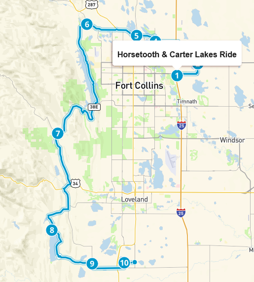 |
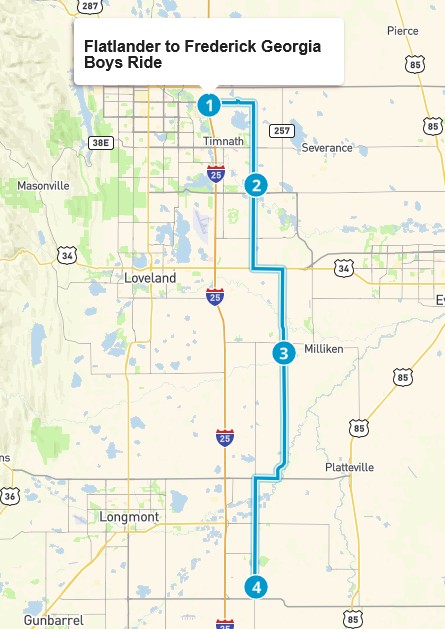 | Flatlander to Frederick Georgia Boys Ride Nice easy flatlander ride starting at the Fort Collins Indian Motorcycle Dealership, and heading South on County roads to Frederick to Georgia Boys BBQ. Route is 41 miles with estimated 1 hour ride time. Straight line ride with no change in altitude. |
| Flatlander Pumphouse Ride A flatlander ride going from the Indian Motorcycle of Fort Collins Dealership to the Pumphouse in Longmont for lunch. This ride goes in somewhat of a U-shape out toward Pawnee Grasslands, then down and back through Greeley and on into Longmont. Route is 102 miles with estimated 2 hour ride time. Little change in altitude with straight roads. | 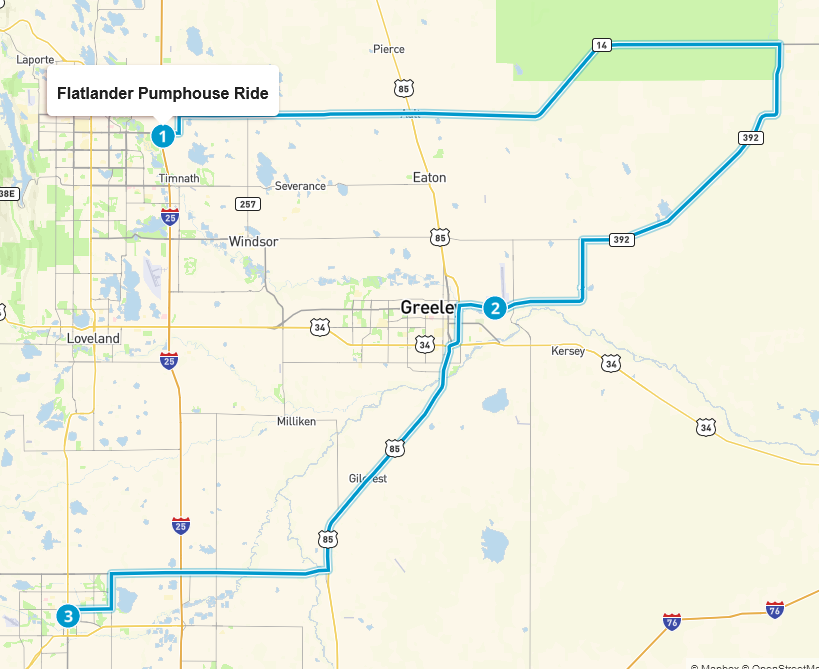 |
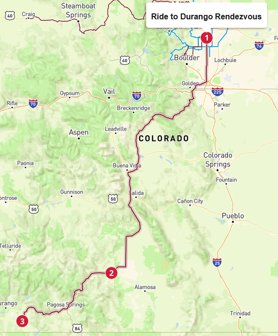 | Ride to Durango Rendezvous Route to Ignacio for the Durango Rendezvous. Lunch stop at Colorado Grille & Tap House in Del Norte. Back highway riding once past Boulder. Route is 356 miles with estimated 7 hour ride time. Riding in flatlands, foot mountains, and mountains. Elevation ranges from 4835 feet to 10,861 feet. |
| Rist Canyon Ride Short mountainous ride with lots of great twisties. A very scenic ride starting from the Dealership and going around Horsetooth Reservoir into Masonville. Then up Buckhorn Rd to Rist Canyon. Head East on Rist to Laporte with ride ending at Vern’s. Route is 61 miles with estimated 2 hour ride time. Foothill and mountain riding with lots of turns. Elevation ranges from 4,905 feet to 7,998 feet. | 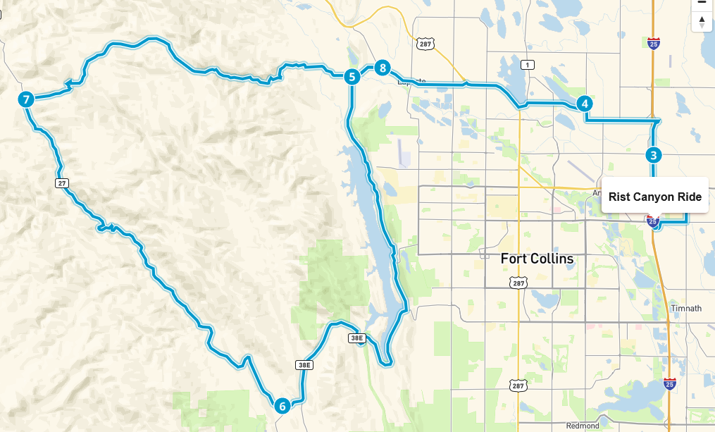 |
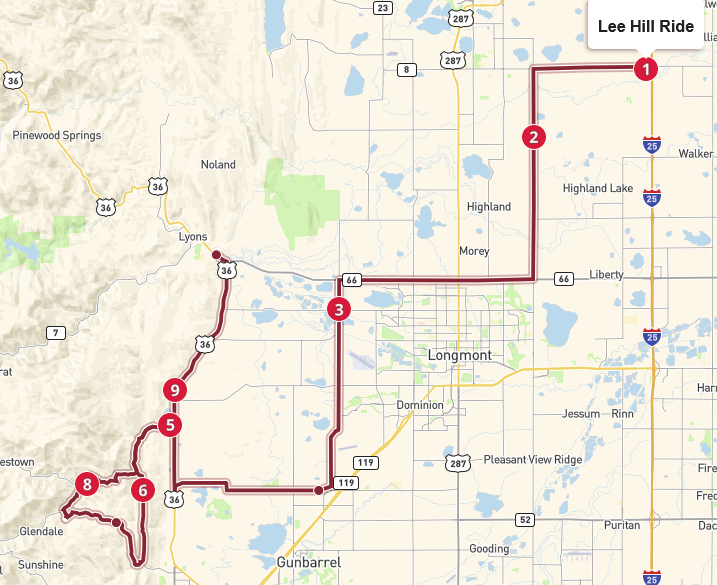 | Lee Hill Ride This ride takes us to the Boulder area where we do a fun twisty loop made by Lefthand Canyon and Lee Hill. Then head to Lyons and back east on Hwy 66 to end the ride. Route is 70 miles with estimated 2 hour ride time. Back County roads to Lefthand Canyon. Lots of fun curves riding in a loop on Lefthand Canyon and Lee Hill. Elevation ranges from 4,862 feet to 6,996 feet. |
| Ride to Steamboat-Craig This is a beautiful and very scenic ride to Craig for an overnight stay starting at Ted’s Place on Hwy 287. This goes through Poudre Canyon, over Cameron Pass and Rabbit Ears. Stop for lunch in Walden. And stop in Steamboat Springs to look around. From Steamboat, we go approximately 40 miles to Craig to spend the night. Route is 192 miles with an approximate ride time of 5 hours. Mountain riding with lots of curvy roads. Elevation ranges from 5,223 feet to 10,274 feet. | 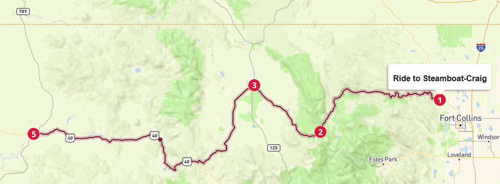 |
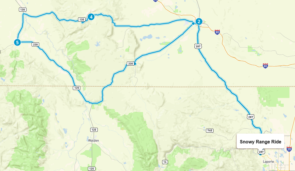 | Snowy Range Ride A beautiful mountain ride across the Snowy Range in Wyoming, and making a loop back on scenic Hwy 230. We go through Laramie to Snowy Range. Lunch stop in Riverside. A rest stop at Woods Landing, then head to Ted’s Place to end the ride. Route is 278 miles with an approximate ride time of 6 hours. Mountain riding with twisty and curvy roads. Elevation ranges from 5,233 feet to 10, 849 feet. |
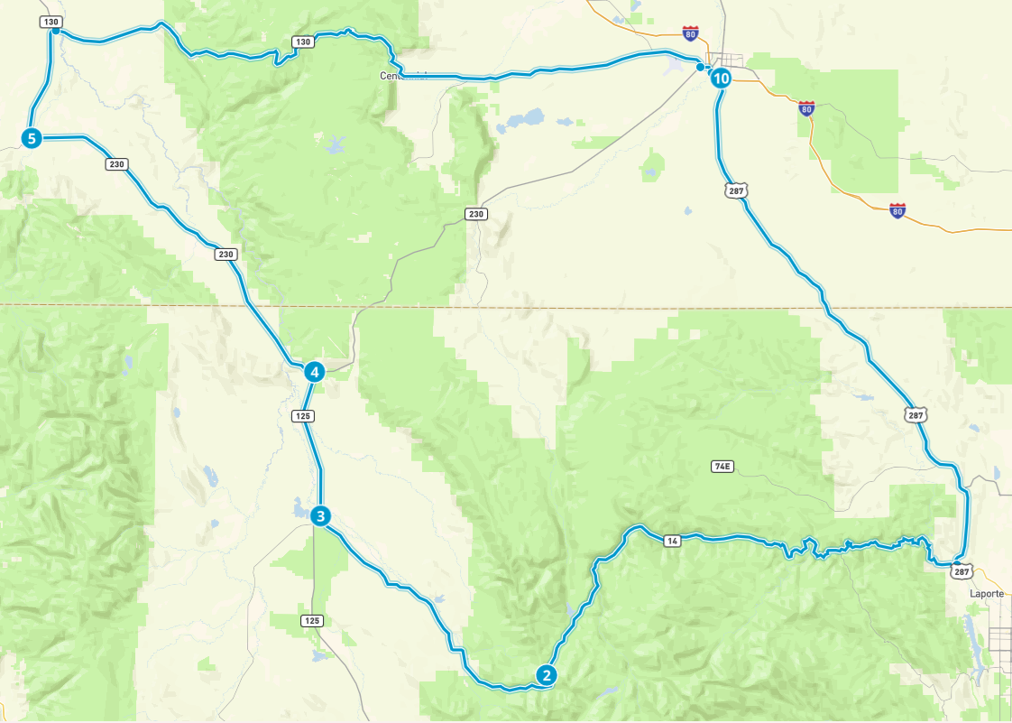 | Snowy Range Ride This route takes you west on Poudre Canyon and crosses Cameron Peak to Walden. From Walden it goes north to the small town of Riverside, WY where you can stop for lunch. Next you cross the Snowy Range going east to Laramie, WY. Finally head south back to Ted’s Place to end the ride. Route is 272 miles with an approximate ride time of 5 hours. Mountain riding with twisty and curvy roads. Elevation ranges from 5,223 feet to 10, 849 feet. |
| Beecher Island Battlefield Ride An epic flat lander ride to Wray and back to visit the Beecher Island battlefield. Mostly flat, with gentle hills here and there. Pass through rolling grasslands, dotted with occasional trees and shrubs. Route is 436 miles with an approximate ride time of 8 hours. Route takes 34 to Brush, then down to 36. Go East to the battlefield. Coming back, take 14 West. Elevation ranges from 3,510 feet to 5,177 feet. | 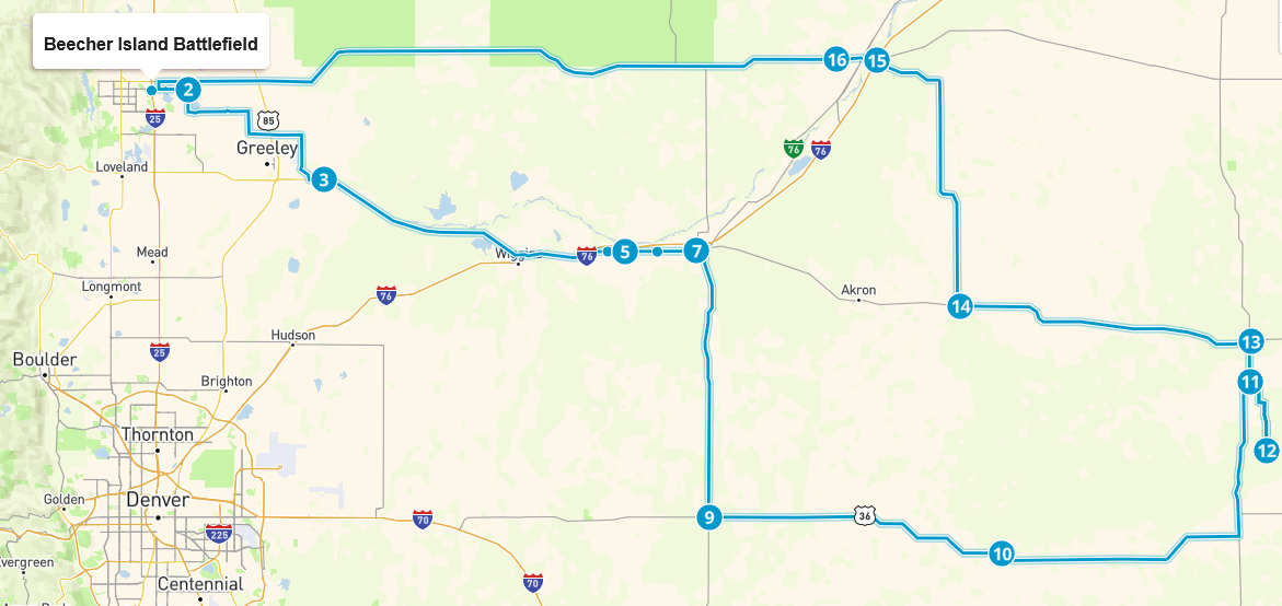 |
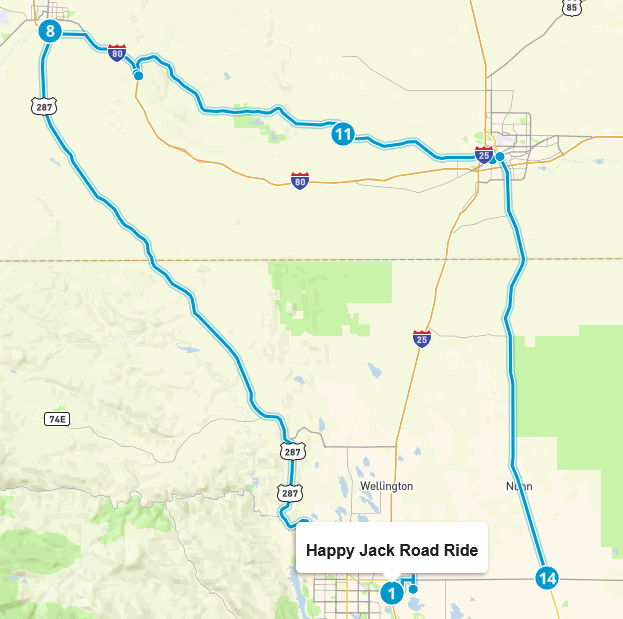 | Happy Jack Road Ride Happy Jack Road is a scenic route connecting Cheyenne and Laramie. The road itself is approximately 37 miles long and winds through the Medicine Bow National Forest. The road is well-maintained and easy to ride. Along the way, you will see a variety of landscapes, including towering mountains, and rolling hills. Ride stops include Abraham Lincoln memorial, and Bunkhouse Bar & Grill for lunch. This ride route is 159 miles with a total of 3 hours saddle time with some highway speeds and short interstate riding. Elevation ranges from 4,904 feet to 8,706 feet. |
| Glenwood Springs Loop Road Trip Multi-night ride. Day 1 Loveland to Red Cliff traversing Trail Ridge Road across Rocky Mountain National Park. Day 2 Red Cliff to Yampa going over Independence Pass to Glenwood Springs than on to Yampa. Day 3 Yampa to Steamboat Springs, over Rabbit Ears and Cameron Pass, down Poudre Canyon to end ride in Laporte. This ride is 591 miles with a total of 14 hours saddle time. Lots of mountain riding with sharp curves and switchbacks. |  |
 | Happy Jack Rd & Poudre Canyon Start out at the Indian Motorcycle of Fort Collins. Ride to Cheyenne going north on Highway 85. In Cheyenne, go west across Happy Jack Rd. Then take I80 for a short way into Laramie. From Laramie, take Highway 287 south to Poudre Canyon (Highway 14). Head east on Poudre Canyon to Stove Prairie Rd. Head south on Stove Prairie, then east on Rist Canyon to Laporte. This ride is 194 miles with a total of 4 hours saddle time. Lots of changing scenery, and curvy roads. H |
| Glen Haven & Peak-to-Peak This ride takes you to Glen Haven for cinnamon rolls at the Glen Haven General Store. The ride continues to Estes Park where it takes you around the back side to Highway 7. Travel down to Allenspark where the Chapel on the rock is located. Continue on to Highway 72 toward Ward. At Ward, take Lefthand Canyon east to Highway 36 and then Highway 66 to finish the ride. This ride is 90 miles with a total of 3 hours saddle time. Lots of changing scenery, and curvy roads, and some switchbacks. |  |
 | Coal Creek Canyon This route takes you through the heart of the Peak to Peak Scenic Byway, Colorado’s oldest scenic route. It’s a classic Front Range journey that transitions from red-rock river canyons to high-alpine meadows, eventually dropping back down through the rugged, sheer walls of Coal Creek. Total route is 101 miles with 3 hours saddle time. Lots of nice curvy roads, and beautiful scenery. |
| Dowdy Lake This is a beautiful lake located in Red Feather Lakes. A great place for a picnic. The ride there is not technical, but is very scenic and relaxing. The 54 mile route starts at Indian Motorcycle of Fort Collins, and takes back roads to avoid going through the center of Fort Collins. You hop on Highway 287 north and will exit onto Red Feather Lakes Road located at the historic “The Forks Mercantile.” From here you will travel about 20 miles to Dowdy Lake Rd. This route is about 54 miles with one hour ride time, and climbs to 8,255 feet. | 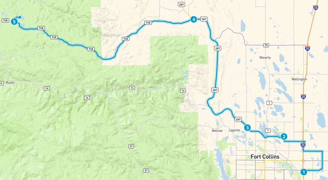 |
 | Meadow Mountain Cafe This small cafe is a beloved, historic landmark in the small mountain town of Allenspark. It has been a staple for those heading to Rocky Mountain National Park for decades. This ride starts at the Indian Motorcycle of Fort Collins and takes back roads out of Fort Collins. You will go along Horsetooth Reservoir and down to Highway 34, turning west to Estes. Get on Peak-to-Peak to Allenspark. 76 miles with lots curvy mountainous riding. 3 hours ride time climbing to 9,134 feet. |